The main product of our company Road.Travel is travel routes, so my task as a product manager was to develop a system of geographical coverage of our routes on the example of one of the five most priority countries to enter the EU market. Using the example of the UK, I will show you how to identify 12 starting cities for our routes.
What additional tasks and criteria were in front of me:
- Go through regions in each of the countries below (Premier, First and Second tiers) to identify missing/uncovered areas, blind spots. Italian provinces, French departments, Germans lands, US and Canada regions etc.
- Identify and agree on the basic number of routes per category per city according to Road.Travel existing categories
- Commission SEO analysis to identify road trips demand in each of the segments to inform prioritisation.
- Use any other relevant data base (global incoming tourism numbers, car hires) to inform prioritiation.
- Agree on ‘city-province-country’ approach - grouping routes between countries, regions, areas.
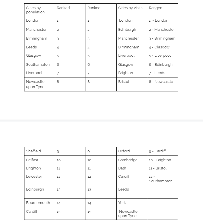
The initial assumption from our strategic consultant was to focus only on the basis of data on international visits to British cities.
I proposed a Road.Travel team a more extensive and comprehensive approach to the definition of 12 starting cities, which covered geographical, agglomeration, statistical and Google Adwords data.
Current approach: